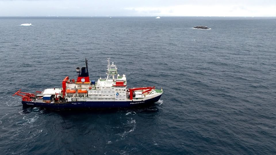

In one of the most surprising polar discoveries of 2026, researchers aboard the German icebreaker Polarstern accidentally discovered a previously unknown island in Antarctica’s Weddell Sea — an area that had been labeled for years as a mysterious “danger zone” on nautical charts.
What initially appeared to be nothing more than a dirty iceberg turned out to be solid rock rising from the icy ocean.
The discovery has drawn worldwide attention because it highlights just how little of Antarctica has actually been explored and accurately mapped.
A Discovery Made During a Storm
The discovery occurred during a scientific expedition organized by the Alfred Wegener Institute (AWI), Germany’s leading polar research center.
A 93-member international research team had been studying the dramatic decline of Antarctic sea ice in the northwestern Weddell Sea aboard the research vessel Polarstern.
However, severe weather forced the crew to temporarily stop their research activities and seek shelter near Joinville Island.
During that pause, bathymetry engineer Simon Dreutter noticed something unusual outside the ship.
At first glance, it looked like an iceberg stained with dirt.
But something about it seemed strange.
As the ship moved closer, researchers realized they were looking at exposed rock — not floating ice.
The “dirty iceberg” was actually a previously uncharted island.
According to AWI researchers, the island measures approximately:
- 426 feet (130 meters) long
- 164 feet (50 meters) wide
- 52 feet (16 meters) above sea level
Scientists immediately began surveying the island using drone imaging and echo sounders to map both the landform and the surrounding seabed.
This was reportedly the first time the region had ever been officially surveyed in detail.
Why Was the Area Marked as a “Danger Zone”?
For years, nautical maps had labeled the region as an “unexplored danger area,” but nobody knew exactly why.
Researchers now believe earlier ships may have detected irregular underwater formations or shallow seabed structures without ever identifying the island itself.
The Weddell Sea is one of the harshest and least explored marine environments on Earth.
Massive ice cover, severe storms, freezing temperatures, and shifting sea ice make accurate mapping extremely difficult.
AWI researchers explained that many Antarctic coastal areas are still considered “white spots” on maps because only low-resolution satellite data exists for large portions of the region.
In fact, scientists estimate that less than 25% of Antarctic waters have been fully charted.
That means vast sections of the continent’s surrounding ocean remain largely unknown even in the modern satellite era.
Antarctica Still Holds Many Mysteries
Although many people assume Earth has already been fully explored, Antarctica continues to surprise scientists.
The continent remains one of the least understood places on the planet.
Hidden beneath thick ice are mountains, lakes, volcanic systems, deep canyons, and possibly many more underwater landforms that have never been documented.
The newly discovered island demonstrates how climate, ice movement, and changing sea conditions can reveal previously hidden features.
Researchers say the island likely remained unnoticed because its ice-covered surface blended almost perfectly with surrounding icebergs in satellite imagery.
Only when scientists approached closely were they able to identify exposed rock.
The island has not yet received an official name.
AWI researchers plan to submit a formal naming proposal to the Scientific Committee on Antarctic Research (SCAR).
Why This Discovery Matters
This discovery is more than just an exciting scientific story.
It also highlights the importance of modern ocean mapping.
Accurate nautical charts are essential for:
- Scientific expeditions
- Climate research
- Maritime safety
- Future Antarctic operations
- Understanding ocean circulation systems
The Weddell Sea plays a major role in global ocean currents and Earth’s climate system.
Scientists are especially interested in how melting Antarctic ice is affecting deep ocean circulation and global sea levels.
As climate change accelerates ice loss in Antarctica, researchers believe more hidden geological features could emerge in the coming decades.
A Reminder That Earth Is Still Unexplored
Even in 2026 — in an age of satellites, artificial intelligence, and advanced navigation systems — parts of our planet remain largely unmapped.
The accidental discovery of a rocky island hidden in one of Earth’s most remote oceans is a powerful reminder that exploration is far from over.
Antarctica still holds countless secrets beneath its ice.
And sometimes, all it takes is a storm, a sharp-eyed scientist, and what looks like a “dirty iceberg” to uncover a completely new piece of our world.